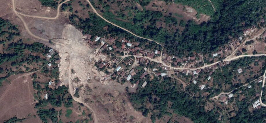
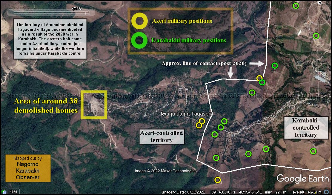
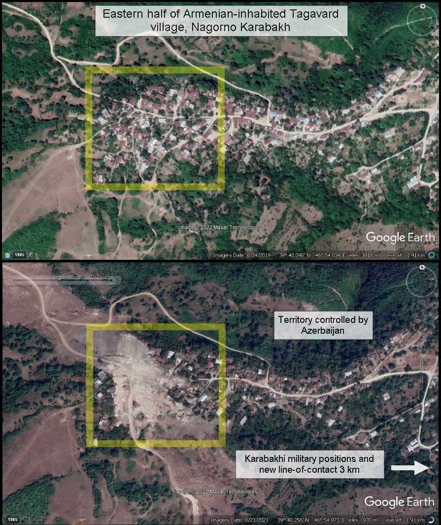
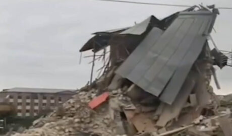
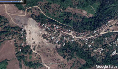
An updated map of Tagavard village, Nagorno Karabakh, with its western half under Azeri military control and eastern under Karabakhi since the 2020 ceasefire, shows around 38 homes demolished.
According to Sentinel Hub maps, the Azeri side demolished the homes between 2 and 12 July 2021.
Military positions dividing the village remain in place since the end of the 2020 Nagorno Karabakh war, during which the Armenian population of the village was evacuated due to Azeri advances from higher ground from the west. No civilian population remains in the area controlled by Azeri forces.
Based off of our Twitter post from 12 June 2022.


Comments are closed, but trackbacks and pingbacks are open.